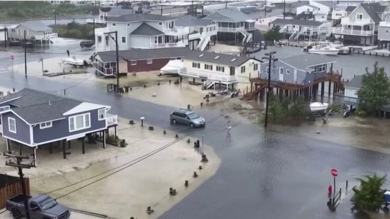
The storm known as Ophelia was downgraded to a tropical depression Saturday evening as it continued to weaken over Mid-Atlantic states, federal forecasters said.
The move from stronger tropical storm to tropical depression triggered the National Hurricane Center to deactivate related storm surge and tropical storm warnings, it said in an 8 p.m. advisory.
"Coastal flooding warnings and wind advisories remain in effect for portions of the U.S. Mid-Atlantic," the advisory stated.
The storm continued to bring heavy rainfall to parts of the Mid-Atlantic after making landfall early Saturday near North Carolina's Emerald Isle.
Spinning out maximum sustained winds of 35 mph, Ophelia was centered about 40 miles south of Richmond, Virginia, on Saturday night, the National Hurricane Center said in an 8 p.m. update.
The storm is expected to continue to weaken and will likely become a post-tropical cyclone by Sunday.
The system brought tropical storm conditions to North Carolina, with rainfall upwards of 1 to 3 inches per hour and sustained winds with gusts of 35 to 45 mph, according to the National Weather Service's field office in Raleigh.
In North Carolina, Tarboro had received 4.31 inches of rain and Winston Salem had 3.97 inches, the weather service's field office in Raleigh said in a rainfall update just before 6 p.m.
In Greenville, North Carolina, on Saturday police rescued a small pit bull terrier they said was inches from drowning in rising floodwater because it was tied to a fence. Animal protective services personnel will investigate, the Greenville Police Department said.
More than 11,000 utility customers were without power in Virginia as of Saturday evening, according to Poweroutage.us. At one point Saturday afternoon, more than 85,000 customers were without power in North Carolina.
Elsewhere in the Mid-Atlantic, rainfall of up to 2 to 4 inches is possible through Sunday. Around 1 to 3 inches of rain is possible across southern New York through southern New England Saturday into Monday.
“This rainfall may produce locally considerable flash, urban, and small stream flooding impacts, particularly across the Mid Atlantic region from North Carolina to New Jersey,” the National Hurricane Center said in an update. “Isolated river flooding is possible in areas of heavier rainfall.”
Late Friday, Maryland Gov. Wes Moore declared a state of emergency in anticipation of flooding, road closures and storm damage.
“If you can avoid driving or being out during the storm please do so,” he said in a statement. “We are expecting an extended period of strong winds, heavy rainfall, and elevated tides.”
On Saturday, the New York City Emergency Management Department issued a travel advisory covering the weekend and advising motorists to drive only if they “must.” As much as 3 inches of rain was expected, the department said.
"Isolated flash flooding cannot be ruled out," it said.
Ophelia is also expected to generate ocean swells that will affect much of the East coast through the weekend that “are likely to cause life-threatening surf and rip current conditions.”
An isolated tornado is also possible along North Carolina’s coast, according to the weather service. Two tornado warnings were in place earlier Saturday morning in parts of northeastern North Carolina.
Severe weather, including heavy rain paired with flooding, hail and tornadoes, is also likely in parts of the Central U.S., including eastern Oklahoma into the Lower Missouri River Valley through Saturday night.


